
The monitoring of volcanoes requires the use of a variety of techniques that can hear and see activity beneath the surface of the Earth and deep below the volcano. Public Seismic Network Inc. (aka DPSN) monitors all of Dominica's volcanoes to detect signs of change that would indicate their reawakening. To fully understand the behaviour of our volcanoes, we intend to employ several types of monitoring techniques. Currently only seismic (earthquake) and InSAR (Interferometric Synthetic-Aperture Radar) monitoring are performed but in the near future, we will begin the monitoring of temperatures at the boiling lake and fumaroles, and ground deformation using GPS receivers on a continuous or near-real-time basis.
|
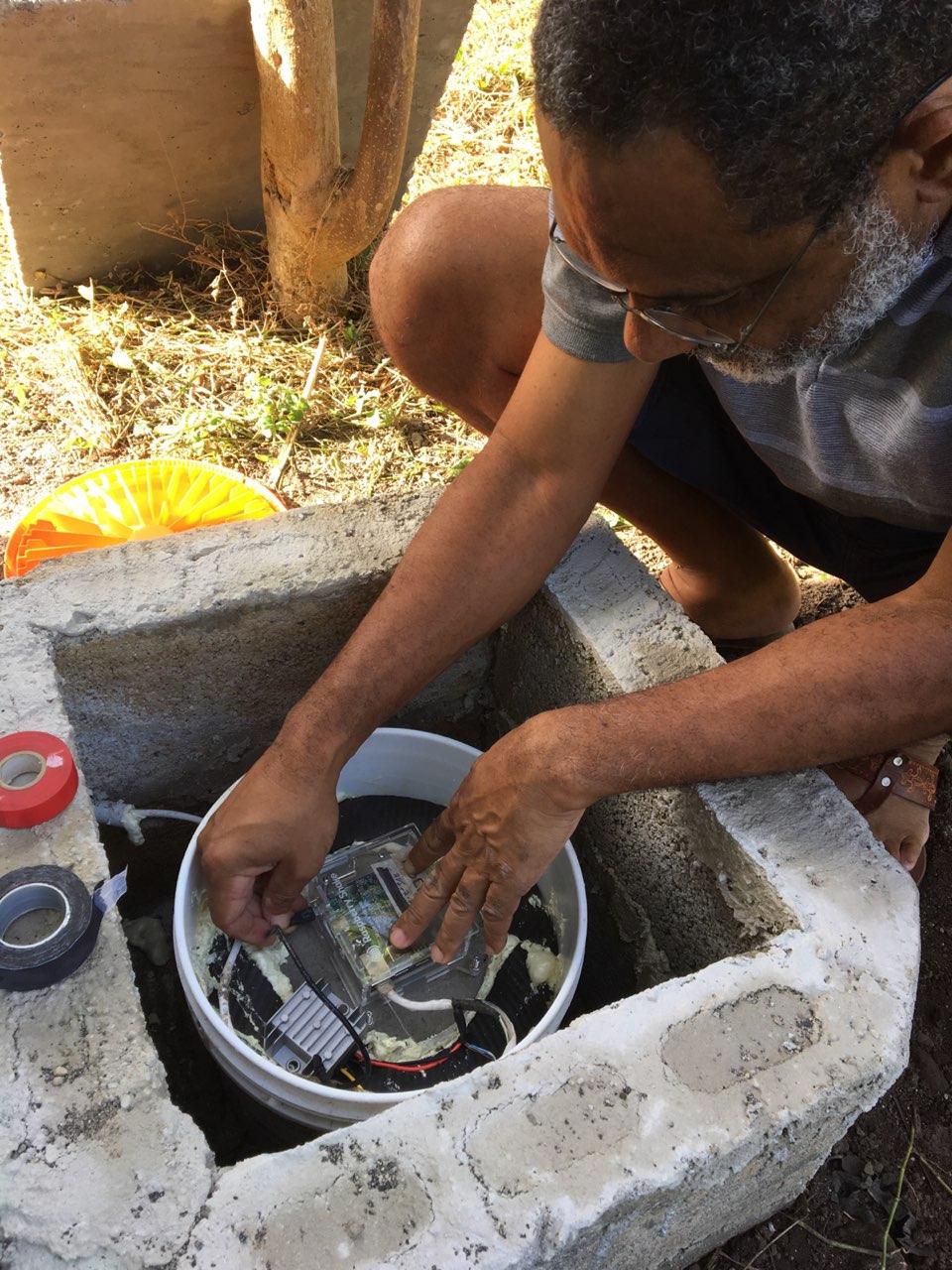
Installing a Seismic Station in Pointe Michel, Dominica |
Seismic Monitoring
Networks of multiple seismographs are necessary to adequately monitor volcanoes. A seismic network, typically 6-8 seismographs within 20 km of a volcano, is required for basic earthquake location capabilities. However, when high-accuracy is critical for tracking subtle changes in earthquake location, networks should have double this number of seismographs within 20 km of the volcano. DPSN currently operates 9 seismographs in its islandwide network and hope to increase that number to 30 in the near future.
|
GPS MonitoringThe Global Positioning System (GPS) consists of a group of satellites that orbit the Earth and continuously transmit information to receivers on the ground. Using these data, it is possible to calculate the exact position of the receiver on the surface of the Earth. With sophisticated receivers and data-analysis techniques, receiver positions can be determined to less than a centimetre which is very important when applied as a volcano monitoring technique.
Changes in the magma system feeding a volcano can actually change the shape of a volcano. When magma moves into the system, pressurizing it, the ground above the magma moves upward and outward, "inflating" like a balloon. Alternatively, the invasion of rising magma may squeeze into near-vertical cracks in the Earth and squeeze /push the ground laterally away from the crack.
To use GPS data for volcano monitoring, multiple receivers are placed around a volcano as a GPS network. In some locations, instruments are permanently installed and record data continuously. However, sometimes the use of a "campaign" GPS network above "benchmarks" (sites with a standard point of reference) where they are temporarily left to record data is a more practical and cost-effective option.
By looking at data from a single receiver over a period of time, movement of the ground surface can be determined. By combining the data collected from a GPS network, it is possible to get a larger view of which areas of the volcano's surface are moving as well as the speed and direction of movement. This large-scale picture of volcano deformation can be used to construct a model of what is happening beneath the surface—for example, the location of any magma reservoirs or active faults. [USGS Volcano Hazard Program]
|


|
Earthquakes recorded by our seismic network in 2019 |
